Mount Washington Winter Ascent via Lion Head Trail
I’ve been bugging Dale to climb Mount Washington with me all winter, and we finally made it happen on March 4, 2016. I had done this trek once before in the winter of 2012, and now I wanted to share the experience with Dale. Bangor has had an extremely mild winter this year, and we haven’t seen snow for weeks. Going to the White Mountains in New Hampshire would allow us to chase winter for a little bit longer.
We decided to drive to New Hampshire the night before our climb. Our first stop was in Augusta to pick up Dale’s beloved thermos that he accidentally left at Panera a few days earlier. He got some decaf coffee, and we had a pleasant three hour drive to our hotel in Conway. We found a place called the Green Granite Inn for $60 a night, and we were extremely happy with our stay. They had a cute lobby with a fireplace, an indoor pool and hot tub (which we didn’t get a chance to use), and free breakfast! We decided to get some hot food, and the only place that was open was the SeaDog Brewery which is funny because SeaDog originated in Bangor. Dale got some chips and salsa and black bean soup, and I got a hummus wrap. We watched some UFC videos and then headed back to the hotel. It was quite chilly outside, and we were not looking forward to the cold temperatures tomorrow!
Dale and I woke up the next morning at 7:00am. We weren’t in a rush to leave because the forecast was predicting a chilly/cloudy morning with the possibility of sunshine later in the afternoon. I used the Mount Washington Observatory’s website because they provide great forecasts and summit conditions. They even have summit webcams that you can view online, and unfortunately the mountain has been in the clouds the past few days. The previous day, the summit had wind chills of -67 degrees with maximum wind gusts of 106mph. Yikes! Luckily today wasn’t going to be as bad, but we were still looking at a wind chill in the -30s.

I brought lots of food with us, but we still made sure to check out the free breakfast. I ended up getting some orange juice and then eating some of my mashed potatoes that I brought from home. I also had some sugar-free cereal with almond milk that I also brought from home. I tried eating as much as possible because I usually lose my appetite when I get up on the mountain, and I wanted all the energy I could get. We brought our electric tea kettle with us to boil water in the hotel and fill our water bottles to prevent them from freezing. Dale and I set all our gear out on the bed to make sure we had everything we needed. We like to pack light, but we made sure to bring enough warm gear and first aid equipment. You can see my full gear list here.
Our drive to the trailhead was about 30 minutes. All the mountains were in the clouds. When we arrived we switched into our snow pants and boots, and we made our way to the Pinkham Notch Visitor Center. This is run by the Appalachian Mountain Club, and they provided a great number of resources for hikers, including a store where you could buy last-minute gear. Dale and I used the bathrooms and started our hike around 10:15am.

Getting everything organized inside the Pinkham Notch Visitor Center

Starting our hike at the Pinkham Notch Visitor Center
Our route up and down was the Lion’s Head Winter Route since this is the safest and least-technical way up. After about a half hour of steady hiking, Dale and I needed to stop to take some layers off. Neither of us had been so hot in our lives hiking, and we were surprised it was on this mountain. I took off my Marmot Dena Jacket, and I was comfortable hiking in just my base layer and fleece. We also had a bite to eat, and we quickly fell in love with our new-favorite trail snack. They’re called Go Raw Sweet Spirulina Sprouted Bites, and it’s basically a dehydrated treat that tastes like a banana coconut smoothie (and it’s healthy!).

Stopping to look at some pretty water

Stopping to de-layer!

Happy and warm in just a fleece and base layer.

Dale’s sweat on his “forehead fuzz” is freezing!
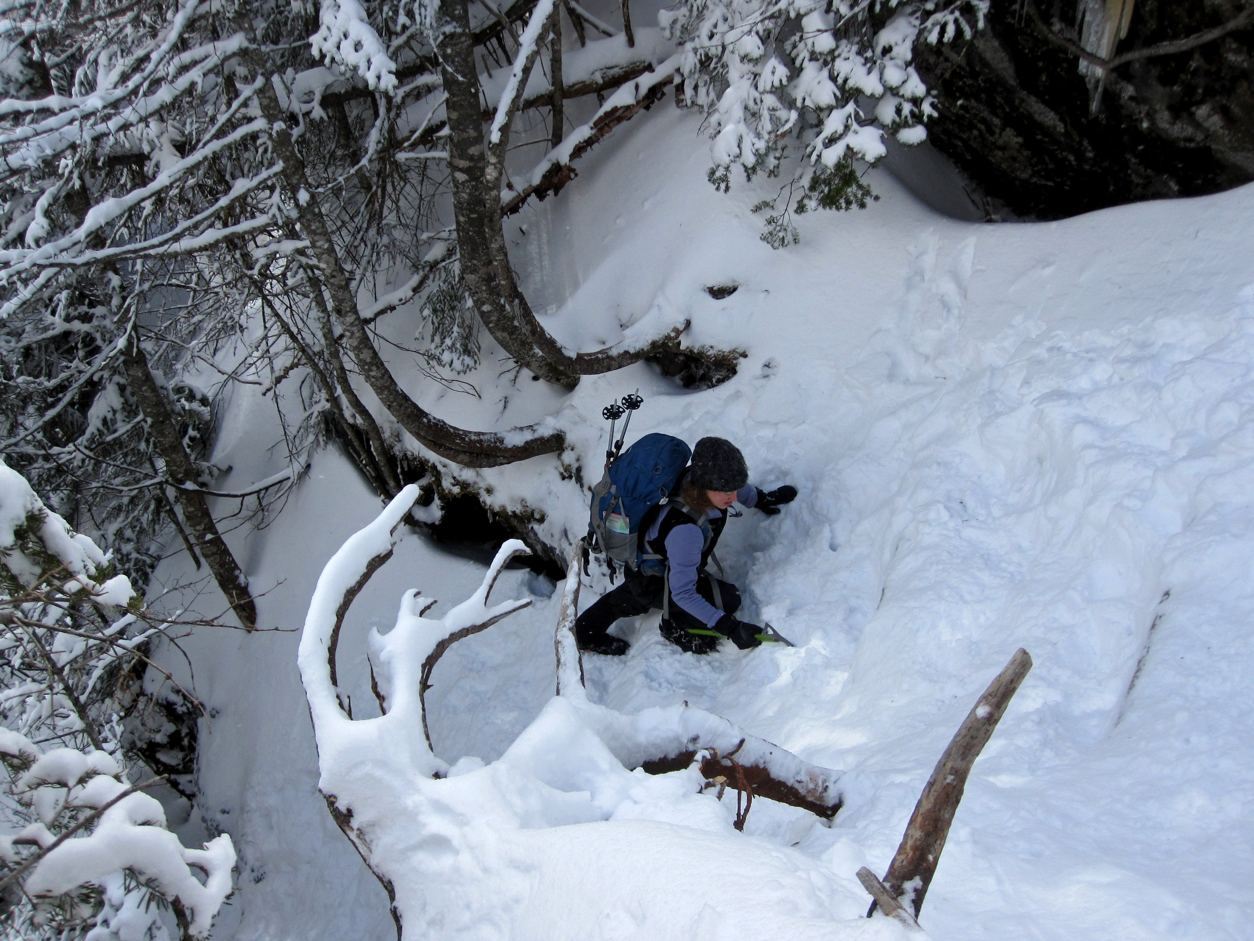
The hiking was very pleasant. It was cloudy and flurrying, and it was super cute and enjoyable. The trail was pretty wide until we made it to the junction of the Lion’s Head Winter Route. It was here that we put on our crampons. The trail got very steep very quick. We hit a spot that was so steep that we had to put our hiking poles away and get out our ice axes. It was a little sketchy, and I could see why some people would want to use a rope here.

The sketchy part.
After the sketchy part, the trail continued to climb steeply. I was using my ice axe probably a little more than I needed to, but I really didn’t want to slip and land on a tree/rock down below! As we continued to climb up, the trees got shorter and fewer. It looked like we would be above treeline soon, so we decided to take a food/water/pee break before we got out in the wind. Despite filling our water bottles with boiling water in the morning, the water was already starting to ice up. As we were eating, two men were coming down from the summit. I asked them how bad the wind was, and they said it was barely windy at all! Great news!
The steep trail continues!
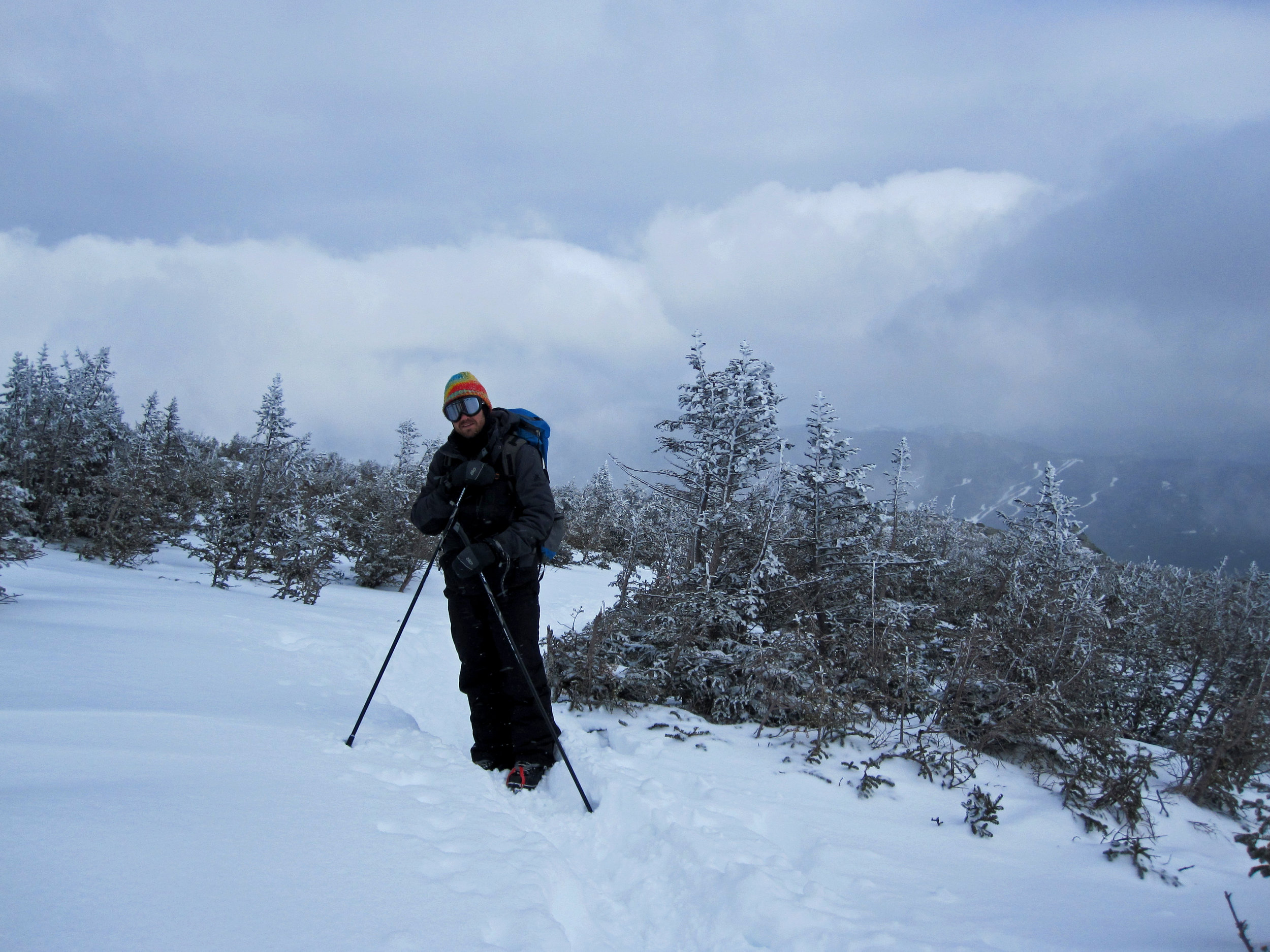
We put our ice axes away, got the hiking poles back out, and put our jackets back on. It was foggy above treeline, but we were able to catch a few views of Tuckerman’s Ravine and Wildcat Mountain. We continued to hike a steady pace. As we were going up we passed a group of young hikers dressed in military gear. They had a Canadian flag on their sleeve, so we assumed they were from some sort of military college.

Putting my warm jacket back on and making sure my spare batteries are warm inside my pocket!
The vegetation thinned out quickly. Dale and I talked about how the trees that were on the “front line” were survivors and have probably spent decades growing to their short stature.
The “front line”. Those trees are survivors!

Looking over at Tuckerman’s Ravine
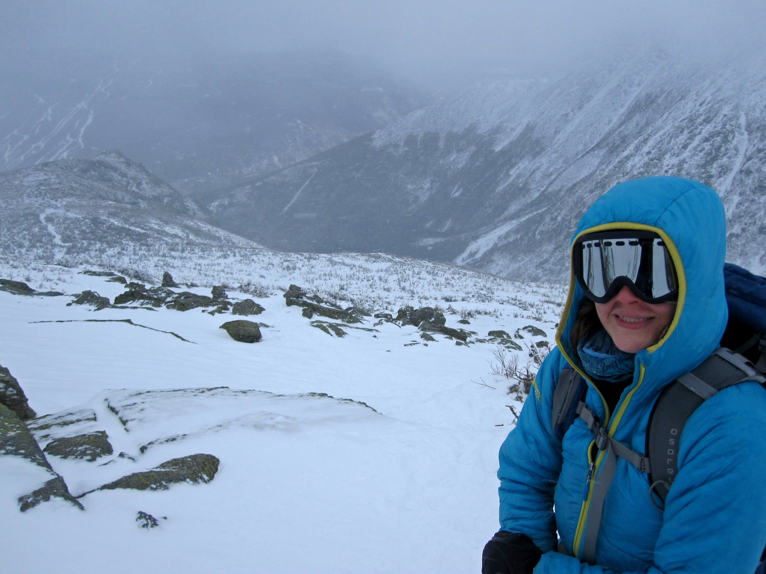
Eventually all the trees disappeared, and we were walking in a desolate tundra. It was here that we started slowing down a little, but we kept putting one foot in front of the other until we made it to the top. As we were hiking up, my goggles started fogging up on me just like they did on my Mount Elbrus trip. I think I just suck at wearing goggles! The fog ended up freezing, and then it was pointless to wear them because I couldn’t see a thing through them. Luckily it was “warm” enough that I was fine without them.

See the cairns?

Getting closer to the summit. These are the last of the trees before getting to the tundra.

One foot in front of the other!
Getting closer!

The tundra continues
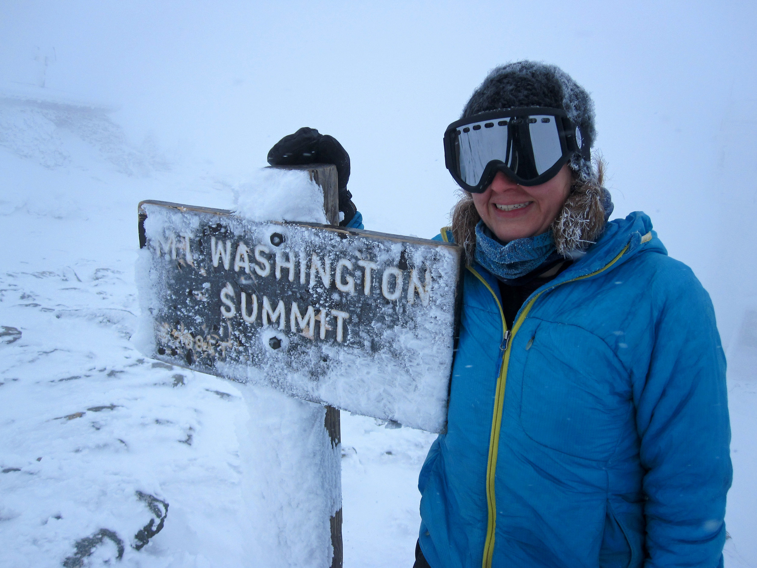
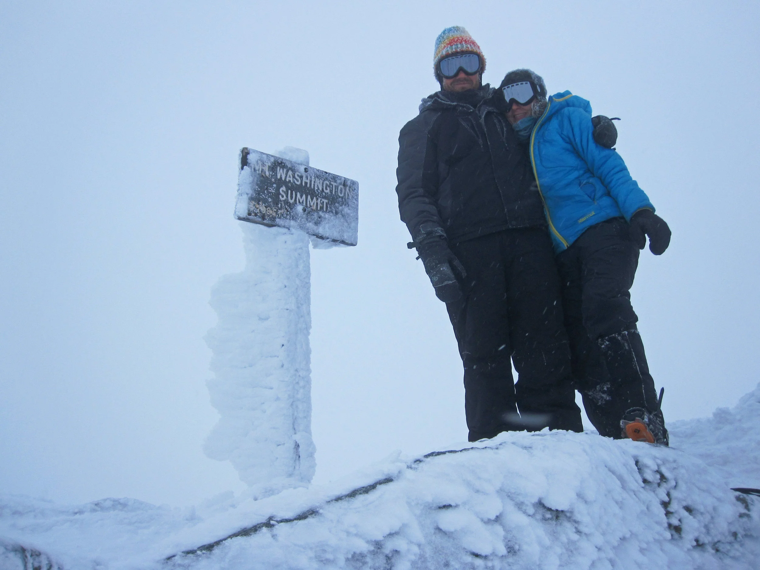
We were way warmer than expected on the summit, but my fingers still got numb pretty quick when I took my gloves off to fiddle with the camera. We got some summit photos, hung out for a little, and then headed back down.


As we made our way down, I started following cairns (rock piles that act as trail markers) towards the Tuckerman Ravine Trail by accident. I thought I was keeping a close eye for our trail, but apparently I missed it in the fog. We took a look at the map and were easily able to cut back across to get back to our trail. Things were pretty uneventful until we got to the steep part again. Dale slid on his butt most of the way down, and I hesitantly took my time on sections that Dale took seconds to get down. Either way, we both made it down safely.

Butt-sliding time!

Getting back to the steep parts

More butt sliding!
As we were hiking the last mile, we met up with a medical student from Rhode Island. He hiked a little bit today and was thinking of doing a Presi Travese tomorrow. A Presi Traverse is an intense hike across all the Presidential Peaks, and it’s quite an ambitious trek even in the summer. Seeing that he didn’t even summit Mount Washington today, we were a bit nervous for him.
We passed another group of people, but they were walking up as were were going down. They looked like they were camping overnight. In the back of the line was a woman carrying one of those big fuzzy camera microphones on her back. We asked her what they were filming, and she said they were videoing the group’s ascent of Mount Washington for Cadillac (yes, the car company). We thought that was pretty cool! I would be interested to see their final product someday.
After 8 hours of hiking, we made it back to Pinkham Notch Visitor Center just as it was getting dark. We were hungry and wet, and as we walked into the lodge, we saw an all-you-can-eat buffet that looked delicious! There were a lot of people in the dining area because there was a ski race close by the next day. We inquired about the dinner, and it was $29 a person. We originally weren’t going to do it because that was a bit steep for our wallets, but the food looked so good and we were so hungry that we couldn’t turn it down! It ended up being just as delicious as it looked, and I didn’t mind supporting the Appalachian Mountain Club. After dinner they were showing a movie, but we wanted to get on the road since we had three hours of driving ahead of us.

Dale and I had a great time on this hike. We were way over-prepared with gear, but all we needed was the wind to pick up for us to end up needing it. The only snafus we had with gear were the following:
My goggles fogged up on me. I don’t think it was a problem with the goggles, but instead a result of me having my hat underneath the top part of the goggle.
Dale’s hiking poles were a bit long and were not adjustable. I like adjustable poles because you can shorten them for the hike up and lengthen them on the way down, but it also helps to be able to shorten them all the way when you attach them to your pack when you’re using your ice axe. When Dale had his poles on his pack, they constantly snagged on trees.
Dale wasn’t wearing gaiters and his $30 snow pants didn’t have any reinforcement on the inner legs, so his crampons snagged on his snow pants quite a bit, leaving them full of holes.

A note on lodging: If you have a long drive, I would highly recommend finding a place to stay the night before and the day of the climb. Although we stayed in a hotel for this trip, we have now become AirBnb addicts because it is cheaper and because we can usually find a place with a kitchen. AirBnb is an online platform that allows you to search for sleeping accommodations all over the world that are hosted by people like you and me. You can choose anything from someone’s couch to your own private villa, and having a host allows you to become more immersed in the local culture (you often never see the host, but they are always available if you need them). Have you tried Airbnb? Sign up with my link here, and you will get up to $55 off your first trip.
Not sure what to bring on your hike? Click here to read Sarah’s Gear Guide for winter hiking up Mount Washington.
